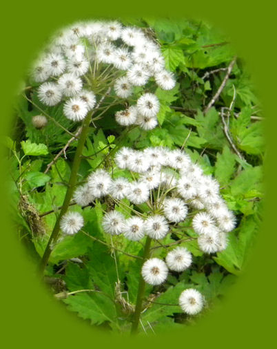
Wild flowers growing along the wild and scenic umpqua river, drive off the rogue umpqua scenic byway, to the trailhead for the medicine creek hiking trails along the north umpqua river.

Traveling the North Umpqua,
a wild and scenic river in Oregon

Forward ~ Campgrounds on the Row River watershed.

Back ~ Travel Directions: the Umpqua River Waterfall Tour.

USFS: Rogue Umpqua National Forest.

Plan your visit to the many waterfalls and hiking trails in the Umpqua National Forest. Want to learn more about the campgrounds on the North Umpqua River and others in the Umpqua River watershed? Brad and I call this the North Umpqua Waterfall Tour: Directions: and Map.

Off the beaten track: Turn off Oregon State Hwy 138 at the transfer site, if you can believe. Pull off the road just before the bridge. Be sure to walk out on the bridge for a site I call paradise. On a little hike down to the river bank, I came across these pretty blossoms. A nice surprise.

Our Getaways offer written Directions, Maps and suggested scenery, spanning Oregon and northern California; places Brad and I have visited and loved. These getaways offer simplicity, yet beauty in scenery, waterfalls, hiking trails, campgrounds, mountains, hot springs, mountain lakes, equestrian trails, mountain biking trails, wild and scenic rivers, scenic byways, Crater Lake National Park, national monuments & more.

Protect our National Forests and Wilderness Areas. Leave NO Trace!
Be sure to check out fire conditions at the Ranger Station before traveling,
hiking or camping in the forest.

Hiking trails are maintained on the Umpqua River Trail. Given no depredations by fire, one can hike the length of the Umpqua from Swiftwater to the headwaters at Maidu Lake.

Scenery: page 1, the Umpqua River, one of Oregon's wild and scenic rivers.

Scenery: page 2, Fern Falls on the Tioga segment of the north Umpqua River Hiking Trail.

Scenery: page 3 and page 4, Susan Creek Waterfall on the Rogue Umpqua Scenic Byway. This trail is wheelchair accessible. And if you want to camp, Susan Creek Campground, page 5.

Scenery: page 6, The hiking trail at Fall Creek, boasts spectacular beauty that seems almost paradisiacal.

Scenery: page 7 Fall Creek Waterfall is very beautiful, not in the way of Toketee Waterfall, but still possessing its own grandeur. Certainly, the beauty of the hiking trail contributes to this ... Be sure to go earlier in the year to get the full effect.

Elevation Rock on the wild and scenic Umpqua River viewed from the Rogue Umpqua Scenic Byway, page 8.

Scenery on Steamboat Creek, tributary to the North Umpqua River: Little Waterfalls, page 8. You have to walk a few steps; for the most part, however, this waterfall is visible right off the road, and "How High Did You Say the Water Was?" Steamboat Creek, page 9. Steamboat Creek Waterfall in May page 10 and in late summer, page 11.

Scenery: page 12, Old Pa on the banks of the wild and scenic Umpqua River in Oregon.

Scenery: page 13, the wild and scenic Umpqua River, looking like paradise, at the Medicine Creek trailhead.

Scenery: Beautiful and amazing - beyond words - Twin Lakes off the wild and scenic Umpqua River, page 14, page 15, page 16, page 17, page 18, page 19, page 20, page 21, page 22, page 23.

Scenery: page 24 and page 25, the beautiful hiking trail to Toketee waterfalls.

Scenery: page 26 and page 27, exquisite and exceptionally beautiful Toketee Waterfall, on the Umpqua River. Toketee means pretty, graceful in Chinook jargon. The trail is .5 a mile. People I've talked to on the trail have complained about all the stairs, and this trail does go up and down stairs, but I tell you in all honesty, this walk is worth every step. The area around Toketee offers hot springs situated in a covered stone pool right on the canyon of the Umpqua River, Toketee Lake, created in the damming of the Umpqua, a campground, and Toketee Ranger station is close at hand if you have any extraneous questions.

Scenery: page 28, beautiful, and as the name implies, crystal clear, Clearwater River.

Scenery: page 29, catch a glimpse of the craggy old warrior from the Rogue Umpqua Scenic Byway, Mt Thielsen.

Scenery: page 30, the trail to Umpqua Hot Springs, with directions too.

Scenery: page 31, page 32, page 33 and page 34, wild and scenic Watson Waterfalls. Plunging over the steep defiles in what almost appears to be an amphitheater. Watson falls is a powerhouse; rated as class 5 waterfall.

Scenery, page 35, Whitehorse Waterfalls, easily viewed from the platform in the parking lot, but you can walk down and around a few steps for a frontal view if you desire.

Scenery: page 36, Clearwater Waterfalls has a charm all its own. It's one of my favorites although Brad doesn't appreciate it in the way I do. I have driven along the Umpqua Scenic Byway more times than I can count, and I always stop to take a look at these falls. The forest ... the way the light falls, the clear flowing stream ... and then there's the waterfall. The waterfall offers a small picnic area and an unimproved campground, meaning there's no water. The roads used to be pretty bad, but the Forest Service had them repaired. There are only 5 or 7 campsites, as well. :-)

Scenery: page 37, Lovely WarmSpring waterfalls, shaped by columnar basalt as Toketee Falls are. Be careful walking up to the edge, there is no wall, but there is a Cliff!

Scenery: page 38, Lemolo waterfalls. Like toketee and umpqua, lemolo has a unique meaning in Chinook jargon: wild and untamed. This waterfall lives up to its name. The hike is rated more difficult with a steady downhill climb that requires and uphill climb to get back out again. No matter, this is an amazing waterfall.

Scenery: page 39, Lemolo Lake, but really a reservoir. Lemolo Lake offers many campgrounds, fishing, a resort - Mt Thielsen peaks up in the background too.

hiking the north umpqua trail in the umpqua national forest; enjoy camping in the umpqua national forest and hiking trails to waterfalls in the wild and scenic umpqua river watershedt: brice creek waterfalls, moon waterfalls, pinard waterfalls, spirit falls; hiking trails off the Rogue Umpqua Scenic byway on the wild and scenic umpqua river in the umpqua national forest: toketee waterfalls, watson falls hiking trails, fall creek falls, susan creek day use area, susan creek hiking trails, susan creek campgrounds off the rogue umpqua scenic byway, toketee campgrounds off the rogue umpqua scenic byway, lemolo campgrounds off the rogue umpqua scenic byway, diamond lake campgrounds, boulder creek campgrounds, canyon creek campgrounds, umpqua national forest campgrounds, clearwater falls campgroud, island campgrounds, lake in the woods campgrounds, bogus creek campgrounds, apple creek campground, steamboat falls campground, williams creek and eagle rock campgrounds, horseshoe bend and canton creek campgrounds, devil's campground on cow creek, cedar creek campground on brice creek, rujada campground on layng creek, whitehorse falls and clearwater falls campgrounds, susan creek waterfalls, north umpqua river, south umpqua river, umpqua river hiking trails accessed off the rogue umpqua scenic byway, forest service campgrounds, blm campgrounds, cavitt creek recreation area, deadline falls, steelhead in the umpqua river, angling, hiking trails to lemolo waterfalls, clearwater waterfalls, whitehorse waterfalls, clearwater river, toketee lake, umpqua hot springs, steamboat creek waterfalls, warm springs waterfalls, lemolo lake; hiking trails on the little river in the umpqua river watershed in the umpqua national forest: wolf creek waterfalls, grotto falls, hemlock waterfalls, hemlock lake, cavitt creek waterfalls, recreation area, shadow waterfalls, yakso waterfalls; hiking trails on the south umpqua river watershed: south umpqua waterfalls, campbell waterfalls, hiking trails in theboulder creek wilderness area, hiking trails in the mt thielsen rogue umpqua divide wilderness area, cathedral waterfalls off the south umpqua river; hiking trails in the row river watershed: moon, spirit and pinard waterfalls.

Clearwater River just below Clearwater Waterfalls pictured to the left, accessed off the Rogue Umpqua Scenic Byway.

Plan your visit to the many waterfalls and hiking trails in the Umpqua National Forest. Want to learn more about the campgrounds on the North Umpqua River and others in the Umpqua River watershed?

Poison Oak can be a problem at these elevations.

Campgrounds in the Row River Watershed

Brice Creek: Cedar Creek Campground, Lund Campground and Hobo Campground.

Sharps Creek: Mineral Camp Campground. Sharps Creek Recreation Area, not associated with the Umpqua National Forest, can be found on Sharps Creek also. It has a great swimming hole.

Layng Creek: Rujada Campground. For more information on camping in the Row River watershed ...

 
Camping in the Umpqua National Forest & those areas managed by the BLM

Directions to campgrounds in the Diamond Lake District of the Umpqua National Forest. Directions to campgrounds in the North Umpqua River district. The campgrounds for both districts are off the Rogue Umpqua Scenic Byway, many are on the wild and scenic Umpqua River. All fall between the north entrance to Crater Lake National Park and I-5 at Roseburg, Oregon. Boulder Flat is the last one in the North Umpqua district. After that you're in the Diamond Lake District. Directions to campgrounds in the Little River watershed of the North Umpqua River. Directions for camping facilities in the Row River watershed of the Umpqua River. Directions to campgrounds on the south Umpqua River also in the Umpqua River watershed.

 
Hiking Trails in the Umpqua River watershed
in the Umpqua National Forest:

Directions for hiking trails to waterfalls and other points of interest in the Row River Watershed of the wild and scenic Umpqua River in the Umpqua National Forest. As well as Directions for the Umpqua River Trail - 12 hiking trails riverside. Directions for hiking trails to the many waterfalls on the wild and scenic Umpqua River off the Rogue Umpqua Scenic Byway. Directions for hiking trails in the south Umpqua watershed. Directions for hiking trails in the Little River watershed. Most within the magnificent Umpqua National Forest.

Enjoy the North Umpqua Waterfalls Tour on the
Rogue Umpqua Scenic Byway:

Can include Crater Lake National Park: Introduction.

Travel Directions, Map and Scenery ~ can include Crater Lake National Park: Introduction. Experience: splendid scenery, hiking trails for intrepid hikers and those with less enthusiam. Enjoy the magnificent the wild and scenic Umpqua River, Umpqua hot springs near Toketee Campground, rafting on the rapids, hiking the beautiful trail along the Umpqua gorge to magnificent Toketee Waterfalls, my favorite, and the favorite of anyone I've ever spoken to. Hike through a forest garden of dense wild rhododendrons at Warm Spring Waterfalls. Hike the trails to experience the wonder of tumultuous Watson Falls. Don't forget Lemolo Waterfalls and Lemolo Lake. And when you arrive at the north entrance partake the splendor of Crater Lake - Enjoy beauty.

Enjoy the Diverse Loop Tour on the Rogue Umpqua
Scenic Byway & Crater Lake Hwy

Includes Crater Lake National Park: Introduction.

Travel Directions, Map and Scenery. Experience: splendid scenery, hiking trails for intrepid hikers and those with less enthusiam, experience the majestic Rogue River Gorge at Union Creek and the Natural Bridge, waterfalls, the Rogue River Hiking Trail, hiking trails to Muir Creek Waterfalls and National Creek Waterfalls all in the Rogue - Siskiyou National Forest. Enjoy hiking trails to Mill Creek Waterfalls, Barr Creek Waterfalls and Pearsoney Waterfalls in Prospect, Oregon. Or just stand on the historic Prospect bridge and enjoy the panorama of the Avenue of Giant Boulders. Hike down to the water's edge if you've a mind to.

Combine the Umpqua Waterfalls and the Diverse Loop Tours

Traveling Oregon on the Rogue Umpqua Scenic Byway and the Crater Lake Hwy: Directions.

Travel Oregon and northern California while staying at Gathering Light ... a retreat
located in southern Oregon near Crater Lake National Park, not far from all the
beauty on the Umpqua Scenic Byway.

Travel the Rogue Umpqua Scenic Byway to the retreat: Travel Directions and Map.

Travel Directions to and Day Trips of around 100 miles the retreat.

Little known Scenic Places, opportunities to photograph nature untrammeled: hiking, sightseeing, wildlife viewing, birding, and more, all near to Crater Lake and the retreat: Directions Map and Scenery.

Website Directory for the travel pages      Home Page

Page Listings to the travel pages

Hiking along the river at Gathering Light ... a retreat located in the klamath basin in southern oregon near crater lake.

Robin stops to rest in a carpet of wildflowers along the river at the retreat, pictured above.

Contact Brad at Gathering Light ... a retreat.