enjoy camping in the umpqua national forest and hiking trails to waterfalls in the wild and scenic umpqua river watershedt: brice creek waterfalls, moon waterfalls, pinard waterfalls, spirit falls; hiking trails off the Rogue Umpqua Scenic byway on the wild and scenic umpqua river in the umpqua national forest: toketee waterfalls, watson falls hiking trails, fall creek falls, susan creek day use area, susan creek hiking trails, susan creek campgrounds off the rogue umpqua scenic byway, toketee campgrounds off the rogue umpqua scenic byway, lemolo campgrounds off the rogue umpqua scenic byway, diamond lake campgrounds, boulder creek campgrounds, canyon creek campgrounds, umpqua national forest campgrounds, clearwater falls campgroud, island campgrounds, lake in the woods campgrounds, bogus creek campgrounds, devil's campground on cow creek, cedar creek campground on brice creek, rujada campground on layng creek, apple creek campgrounds, whitehorse falls campground, susan creek waterfalls, north umpqua river, south umpqua river, umpqua river hiking trails accessed off the rogue umpqua scenic byway, forest service campgrounds, blm campgrounds, travel oregon through the cascade mountains, cavitt creek recreation area, deadline falls, steelhead in the umpqua river, angling, hiking trails to lemolo waterfalls, clearwater waterfalls, whitehorse waterfalls, clearwater river, toketee lake, umpqua hot springs, steamboat creek waterfalls, warm springs waterfalls, lemolo lake; hiking trails on the little river in the umpqua river watershed in the umpqua national forest: wolf creek waterfalls, grotto falls, hemlock waterfalls, hemlock lake, cavitt creek waterfalls, recreation area, shadow waterfalls, yakso waterfalls; hiking trails on the south umpqua river watershed: south umpqua waterfalls, campbell waterfalls, hiking trails in theboulder creek wilderness area, hiking trails in the mt thielsen rogue umpqua divide wilderness area, cathedral waterfalls off the south umpqua river; hiking trails in the row river watershed: moon, spirit and pinard waterfalls.

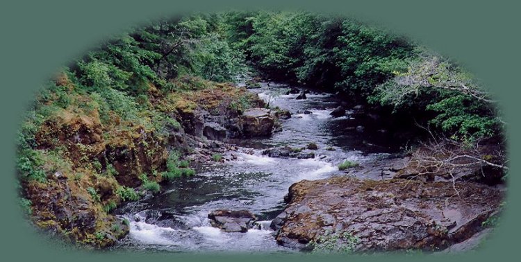
The Little River in June, late spring.

Camping in the Umpqua National Forest

Campgrounds in the Little River Watershed in the Umpqua National Forest

Plan your visit to the many waterfalls and hiking trails in the Umpqua National Forest.

Glide, Oregon is located 16 miles east of Roseburg, Oregon.
Roseburg is located on I -5.

Cavitt Creek Falls Recreation Area

Find the North Umpqua Ranger Station across from the Colliding Rivers Wayside in Glide, Oregon. Drive west .10 of a mile - see the 16 mile marker - to Little River Road (County Road 17). Turn left onto Little River Road, #17. Drive 6.7 miles to the Covered Bridge, turn right onto the bridge, Cavitt Creek Road, and continue for 3.2 miles to Cavitt Creek Falls Recreation Site.

Attractons: This is a lovely campground - day use area. Enjoy the swimming hole at the base of Cavitt Creek Waterfall, fishing for trout in Cavitt Creek and Little River. The hiking trail to Wolf Creek Waterfalls is nearby. Drive further out into the forest, and find the hiking trail for Shadow Waterfalls. Directions to the hiking trails and waterfalls in Little River watershed of the Umpqua River. For more specific information: Roseburg office of the BLM.

Wolf Creek Campground

Find the North Umpqua Ranger Station across from the Colliding Rivers Wayside in Glide, Oregon. Drive west .10 of a mile - see the 16 mile marker - to Little River Road (County Road 17). Turn left onto Little River Road, #17. Drive 12 miles to Wolf Creek Campground.

Attractions: The campground is situated on Little River giving easy access for swimming and fishing. It's also not far from the hiking trail for Wolf Creek Waterfalls. In addition, Nature Trail, #1508, is neary. Directions to hiking trails in the Little River watershed. Abundant wildflowers can be seen in spring. For more specific information about this campground: USFS Umpqua National Forest.

Coolwater Campground

Find the North Umpqua Ranger Station across from the Colliding Rivers Wayside in Glide, Oregon. Drive west .10 of a mile - see the 16 mile marker - to Little River Road (County Road 17). Turn left onto Little River Road, #17. Drive 15.5 miles to Coolwater Campground located on the right side of the road.

Attractions: Coolwater Campground is located on the Little River in a pretty forest with access to swimming and fishing. Just a few of the scenic hiking trails in the area include: Grotto Falls hiking trail, #1503, within 5 miles, Wolf Creek Falls hiking trail, within 5 miles, and more. Directions to the hiking trails and waterfalls for Little River. Coolwater Campground can accomodate trailers up to 24' long. For more specific information about Coolwater Campground: USFS Umpqua National Forest.

White Creek Campground

Find the North Umpqua Ranger Station across from the Colliding Rivers Wayside in Glide, Oregon. Drive west .10 of a mile - see the 16 mile marker on 138 - to Little River Road (County Road 17, FS Road 27). Turn left onto Little River Road, #17, and drive 17 miles to FS #2792, Red Butte Road. Continue .25 miles to White Creek Campground on the left.

White creek Campground is situated on a sandy beach on Little River with shallow water. The hiking trails for Wolf Creek and Grotto Waterfalls are nearby. Directions to hiking trails in the Little River watershed. White Creek campground can accomodate NO trailers. For more specific information: USFS Umpqua National Forest.

Lake in the Woods Campground

Find the North Umpqua Ranger Station across from the Colliding Rivers Wayside in Glide, Oregon. Drive west .10 of a mile - see the 16 mile marker - to Little River Road (County Road 17, FS Road 27). Turn left onto Little River Road, #17, which will turn into FS #27 in about 20 miles, at which point it will be gravel. Drive 27 miles* on #17 - #27 to the campground. *Cited on the website for the Umpqua National Forest, while the brochure Thundering Waters, distributed by the Umpqua National Forest, the BLM and the city of Roseburg, says the drive is 25.8. 7 of which are gravel.

Attractions: Lake in the Woods in a man made reservoir, 8 feet at its deepest point. Boats are allowed, but NO Motors. Wonderful hiking trails to Yakso and Hemlock Waterfalls. The hiking trail for Clover Waterfalls within .5 mile from the campground. Hemlock Lake about 5 miles east of Lake in the Woods. Directions to the hiking trails and waterfalls for the Little River. Lake in the Woos Campground can accomodate trails up 35'. For more information about Lake in the Woods Campground: USFS Umpqua National Forest.

Hemlock Lake Campground

Find the North Umpqua Ranger Station across from the Colliding Rivers Wayside in Glide, Oregon. Drive west .10 of a mile - see the 16 mile marker on 138 - to Little River Road (County Road 17, FS Road 27). Turn left onto Little River Road, #17, which will turn into FS #27 in 20 miles, at which point it will be gravel. Drive 32 miles on #17 - #27 to the campground.

Attractions: Hemlock Lake Campground is located on a man-made mountain reservoir. It's 28 acres and 33' at its deepest point. A boat ramp is located at Hemlock Meadows: 1/2 mile around the east arm of the lake, no mottors are allowed. Hiking trails in the area include a one-mile loop trail around the lake and the 5 mile Yellow Jacket Loop Trail #1522 which connects with a 1 mile side trail, #1516, to Flat Rock Mt. Flat Rock Mt was once used as an emergency lookout. Yellow Jacket Loop Trail passes through high elevation timber and alpine meadows abundant with wildflowers in the spring. Lake in the Woods, another man made reservoir is 3 miles to the west. At Lake in the Woods find the hiking trails to Hemlock and Yakso Waterfalls. Directions to the hiking trails to waterfalls and other points of interest on the Little River. Directions to the hiking trails and waterfalls in the Little River watershed. For more specific information: USFS Umpqua National Forest.

Forward ~ Map of the wild and scenic Umpqua River and surrounding environs.

Back ~ Hiking trails in the Little River watershed.

USFS: Umpqua National Forest.

Poison Oak can be a problem.

Plan your visit to the many waterfalls and hiking trails
in the Umpqua National Forest.

The bridge across Little River at the trailhead for the hiking trail to Wolf Creek Waterfalls, depicted to the right.

Protect our National Forests and wilderness
areas. Leave no trace!

enjoy camping in the umpqua national forest and hiking trails to waterfalls in the wild and scenic umpqua river watershedt: brice creek waterfalls, moon waterfalls, pinard waterfalls, spirit falls; hiking trails off the Rogue Umpqua Scenic byway on the wild and scenic umpqua river in the umpqua national forest: toketee waterfalls, watson falls hiking trails, fall creek falls, susan creek day use area, susan creek hiking trails, susan creek campgrounds off the rogue umpqua scenic byway, toketee campgrounds off the rogue umpqua scenic byway, lemolo campgrounds off the rogue umpqua scenic byway, diamond lake campgrounds, boulder creek campgrounds, canyon creek campgrounds, umpqua national forest campgrounds, clearwater falls campgroud, island campgrounds, lake in the woods campgrounds, bogus creek campgrounds, devil's campground on cow creek, cedar creek campground on brice creek, rujada campground on layng creek, apple creek campgrounds, whitehorse falls campground, susan creek waterfalls, north umpqua river, south umpqua river, umpqua river hiking trails accessed off the rogue umpqua scenic byway, forest service campgrounds, blm campgrounds, travel oregon through the cascade mountains, cavitt creek recreation area, deadline falls, steelhead in the umpqua river, angling, hiking trails to lemolo waterfalls, clearwater waterfalls, whitehorse waterfalls, clearwater river, toketee lake, umpqua hot springs, steamboat creek waterfalls, warm springs waterfalls, lemolo lake; hiking trails on the little river in the umpqua river watershed in the umpqua national forest: wolf creek waterfalls, grotto falls, hemlock waterfalls, hemlock lake, cavitt creek waterfalls, recreation area, shadow waterfalls, yakso waterfalls; hiking trails on the south umpqua river watershed: south umpqua waterfalls, campbell waterfalls, hiking trails in theboulder creek wilderness area, hiking trails in the mt thielsen rogue umpqua divide wilderness area, cathedral waterfalls off the south umpqua river; hiking trails in the row river watershed: moon, spirit and pinard waterfalls.

Hiking Trails in the Umpqua River watershed in the Umpqua National Forest:

Directions for hiking trails to waterfalls and other points of interest in the Row River Watershed of the wild and scenic Umpqua River in the Umpqua National Forest. As well as Directions for the Umpqua River Trail - 12 hiking trails riverside. Directions for hiking trails to the many waterfalls on the wild and scenic Umpqua River off the Rogue Umpqua Scenic Byway. Directions for hiking trails in the south Umpqua watershed. Directions for hiking trails in the Little River watershed. All within the magnificent Umpqua National Forest.

Enjoy the North Umpqua Waterfalls Tour on the Rogue Umpqua Scenic Byway:

Can include Crater Lake National Park: Introduction.

Travel Directions, Map and Scenery ~ can include Crater Lake National Park: Introduction. Experience: splendid scenery, hiking trails for intrepid hikers and those with less enthusiam. Enjoy the magnificent the wild and scenic Umpqua River, Umpqua hot springs near Toketee Campground, rafting on the rapids, hiking the beautiful trail along the Umpqua gorge to magnificent Toketee Waterfalls, my favorite, and the favorite of anyone I've ever spoken to. Hike through a forest garden of dense wild rhododendrons at Warm Spring Waterfalls. Hike the trails to experience the wonder of tumultuous Watson Falls. Don't forget Lemolo Waterfalls and Lemolo Lake. And when you arrive at the north entrance partake the splendor of Crater Lake - Enjoy beauty.

Enjoy the Diverse Loop Tour on the Rogue Umpqua Scenic Byway & Crater Lake Hwy:

Includes Crater Lake National Park: Introduction.

Travel Directions, Map and Scenery. Experience: splendid scenery, hiking trails for intrepid hikers and those with less enthusiam, experience the majestic Rogue River Gorge at Union Creek and the Natural Bridge, waterfalls, the Rogue River Hiking Trail, hiking trails to Muir Creek Waterfalls and National Creek Waterfalls all in the Rogue - Siskiyou National Forest. Enjoy hiking trails to Mill Creek Waterfalls, Barr Creek Waterfalls and Pearsoney Waterfalls in Prospect, Oregon. Or just stand on the historic Prospect bridge and enjoy the panorama of the Avenue of Giant Boulders. Hike down to the water's edge if you've a mind to.

Combine the Umpqua Waterfalls and the Diverse Loop Tours

Traveling Oregon on the Rogue Umpqua Scenic Byway and the Crater Lake Hwy: Directions.

Travel Oregon and northern California while staying at Gathering Light ... a retreat
located in southern Oregon near Crater Lake National Park.

stay in the cabins at gathering light retreat located in southern oregon near crater lake national park and travel oregon and experience volcanoes, geology, hiking trails, oregon geology, rogue siskiyou national forest, wild and scenic rogue river, wild and scenic umpqua river, rogue gorge at union creek, oregon, national rogue river hiking trail, rogue national forest, national forests, wilderness areas, 
national wildlife refuges, wetlands, klamath basin, prospect, oregon, mill creek waterfalls on the rogue river, barr creek waterfalls on the rogue river, avenue of giant boulders on the rogue river, hiking trails to mill creek waterfalls, hiking trails to barr creek waterfalls on the rogue river, hiking trails to national creek waterfalls in the rogue siskiyou national forest, hiking trails along the rogue river, hiking trails to the natural bridge, hiking trails at crater lake national park, crater lake national park, hiking trails on the wild and scenic rogue river, 
iking trails to national creek waterfalls, national wildlife refuges, wetlands, rabbit ears, the cascade mountains, the old cascade mountains, mt thielsen, hiking trails at crater lake, crater lake national park.

Travel the Rogue Umpqua Scenic Byway to the retreat: Travel Directions Map and Scenery. Experience the grandeur of Toketee, Lemolo & Watson Falls, the beauty of the wild & scenic Umpqua River in the Umpqua National Forest & Crater Lake National Park.

Directions to and Day Trips of about 100 miles from the retreat.

Little known Scenic Places to explore nature: hiking with and without trails, wetlands, national wildlife refuges, wildlife viewing, mountains, wilderness areas, river gorges and more near Crater Lake National Park and the retreat: Travel Directions, Map and Scenery.

Website Directory for the travel pages      Home Page

Page Listings to the travel pages

The path at Wood River Wetlands, one of the birding trails not far from the retreat, pictured to the left.

Contact Brad at Gathering Light ... a retreat.