The Verge in a Temperate Rainforest.

driving in the forest to the trailhead for shadow waterfalls. travel oregon in the umpqua national forest, hiking trails on the wild and scenic umpqua river in the umpqua national forest in the cascade mountains of oregon. hiking trails, fishing, salmon, steelhead, waterfalls, swimming, camping, picnicking on the river and at toketee and lemolo lakes, hiking the umpqua river trail from swiftwater falls to maidu lake at the source. drive on one the many wild and scenic byways in oregon, the rogue umpqua scenic byway to crater lake national park in oregon along the one of the many wild and scenic rivers in oregon, the wild and scenic umpqua river.

A brief stop roadside, hoping to bring the
verge of the temperate rainforest alive in a photograph.

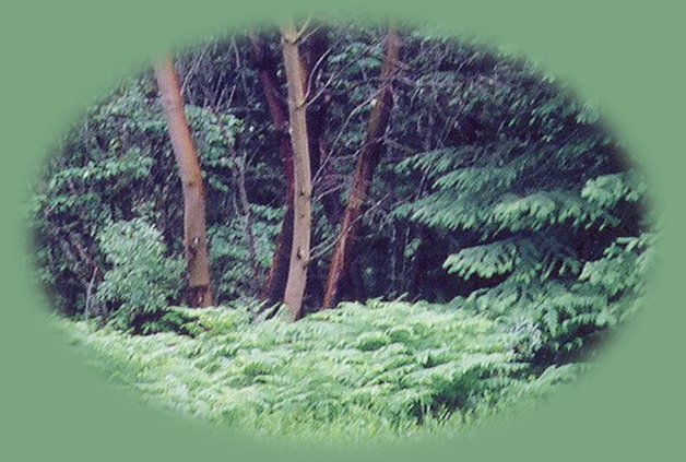
A few qualifications about driving out and about to hiking trails and waterfalls such as this drive to the trailhead at Shadow Waterfalls. Landslides are a very real possibility. Those brief nine miles I traveled on the gravel road gave evidence of several, not just one or two, where the entire side of the mountain had plunged downhill, uprooting trees and anything else that had been living there. Indeed, in one place I found large wood chips scattered across the road. I was driving alongside a cleared space, logs cut into manageable pieces and slash piles, the hillside a scar of mud, evidence of a recently cleared landslide.

The view looking down the mountain in places where landslides have occurred is quite amazing. Both sides of the slide are dense in trees and undergrowth, but that one place is devoid of anything but evidence of earth plummeting downhill with amazing, destructive force.

Protect our National Forest and Wilderness Areas. Leave NO Trace!

fall creek waterfalls in the wild and scenic north umpqua river watershed. the wild and scenic umpqua river in the umpqua national forest in the cascade mountains of oregon. hiking trails, fishing, salmon, steelhead, waterfalls, swimming, camping, picnicking on the river and at toketee and lemolo lakes, hiking the umpqua river trail from swiftwater falls to maidu lake at the source. drive a beautiful route to crater lake national park along the umpqua river.

Forward ~ The Watcher in the Woods, the trailhead for Wolf Creek Waterfalls.

Back ~ Shadow Falls in the Umpqua National Forest
in the Cascade Mountains of Oregon.

USFS: Umpqua National Forest. BLM: Roseburg
District of the Bureau of Land Management.

Plan your visit to the many waterfalls and hiking trails in the Umpqua National Forest. Want to learn more about the campgrounds on the North Umpqua River and others in the Umpqua River watershed?

The Little River depicted in the photo to the left.

 
Camping in the Umpqua National Forest & those areas managed by the Roseburg BLM

Directions to campgrounds in the Diamond Lake District of the Umpqua National Forest. Directions to campgrounds in the North Umpqua River district. The campgrounds for both districts are off the Rogue Umpqua Scenic Byway, many are on the wild and scenic Umpqua River. All fall between the north entrance to Crater Lake National Park and I-5 at Roseburg, Oregon. Boulder Flat is the last one in the North Umpqua district. After that you're in the Diamond Lake District. Directions to campgrounds in the Little River watershed of the North Umpqua River. Directions to camping facilities in the Row River watershed of the Umpqua River. Directions to campgrounds on the south Umpqua River also in the Umpqua River watershed.

 
Hiking Trails in the Umpqua River watershed in the Umpqua National Forest:

Directions for hiking trails to waterfalls and other points of interest in the Row River Watershed of the wild and scenic Umpqua River in the Umpqua National Forest. As well as Directions for the Umpqua River Trail - 12 hiking trails riverside. Directions for hiking trails to the many waterfalls on the wild and scenic Umpqua River off the Rogue Umpqua Scenic Byway. Directions for hiking trails in the south Umpqua watershed. Directions for hiking trails in the Little River watershed. All within the magnificent Umpqua National Forest.

Enjoy the North Umpqua Waterfalls Tour on the Rogue Umpqua Scenic Byway:

Can include Crater Lake National Park: Introduction.

Travel Directions, Map and Scenery ~ can include Crater Lake National Park: Introduction. Experience: splendid scenery, hiking trails for intrepid hikers and those with less enthusiam. Enjoy the magnificent the wild and scenic Umpqua River, Umpqua hot springs near Toketee Campground, rafting on the rapids, hiking the beautiful trail along the Umpqua gorge to magnificent Toketee Waterfalls, my favorite, and the favorite of anyone I've ever spoken to. Hike through a forest garden of dense wild rhododendrons at Warm Spring Waterfalls. Hike the trails to experience the wonder of tumultuous Watson Falls. Don't forget Lemolo Waterfalls and Lemolo Lake. And when you arrive at the north entrance partake the splendor of Crater Lake - Enjoy beauty.

Enjoy the Diverse Loop Tour on the Rogue Umpqua Scenic Byway and the Crater Lake Hwy:

Includes Crater Lake National Park: Introduction.

Travel Directions, Map and Scenery. Experience: splendid scenery, hiking trails for intrepid hikers and those with less enthusiam, experience the majestic Rogue River Gorge at Union Creek and the Natural Bridge, waterfalls, the Rogue River Hiking Trail, hiking trails to Muir Creek Waterfalls and National Creek Waterfalls all in the Rogue - Siskiyou National Forest. Enjoy hiking trails to Mill Creek Waterfalls, Barr Creek Waterfalls and Pearsoney Waterfalls in Prospect, Oregon. Or just stand on the historic Prospect bridge and enjoy the panorama of the Avenue of Giant Boulders. Hike down to the water's edge if you've a mind to.

Combine the Umpqua Waterfalls and the Diverse Loop Tours

Traveling Oregon on the Rogue Umpqua Scenic Byway and the Crater Lake Hwy: Directions.

Travel Oregon and northern California while staying at Gathering Light ... a retreat
located in southern Oregon near Crater Lake National Park.

Travel on the Rogue Umpqua Scenic Byway to Gathering Light ... a retreat: Directions Map and Scenery: Experience the columnar basalt of Toketee Waterfalls, tumultuous Watson Falls ... the wild & scenic Umpqua River. Arriving at the north entrance of Crater Lake, enjoy Crater Lake National Park too.

Directions to and Day Trips of about 100 miles from the retreat.

Little known Scenic Places to explore and photograph nature untrammeled: hiking with or without trails, wetlands, national wildlife refuges, mountains, wilderness areas and more, all near to Crater Lake and the retreat in the Klamath Basin: Directions Map and Scenery.

stay in the cabins at gathering light retreat located in southern oregon near crater lake national park and travel oregon and northern california and see lava beds national monument, the skull cave, mcarthur burney waterfalls, mcarthur burney hiking trails, mcarthur burney state park, mt shasta, hike from bunny flats on mt shasta, castle lake, shasta city, california, dunsmuir, california, mccloud, california, mccloud river, sacramento river, upper mccloud river waterfalls, middle mccloud river waterfalls, lower mccloud river waterfalls, hiking trails along the mccloud river, along the sacramento river, on mt shasta, hiking trails to hedge creek waterfalls in dunsmuir, california, hiking trails along the sacramento river to mossbrae waterfalls in dunsmuir, california, castle crags state park, hiking trails in castle crags wilderness area, camping in castle crags state park, camping on the mccloud river at fowler creek campground, hiking trails to mountain lakes, hiking trails around castle lake, volcanoes, geology, oregon geology, california geology, shasta trinity national forest, rogue national forest, national forests, wilderness areas, russian wilderness areas, castle crags wilderness areas, lava flows, lava beds national monument, experience volcanoes, geology, hiking trails, oregon geology, rogue siskiyou national forest, wild and scenic rogue river, wild and scenic umpqua river, rogue gorge at union creek, oregon, national rogue river hiking trail, rogue national forest, national forests, wilderness areas, national wildlife refuges, wetlands, klamath basin, prospect, oregon, mill creek waterfalls on the rogue river, barr creek waterfalls on the rogue river, avenue of giant boulders on the rogue river, hiking trails to mill creek waterfalls, hiking trails to barr creek waterfalls on the rogue river, hiking trails to national creek waterfalls in the rogue siskiyou national forest, hiking trails along the rogue river, hiking trails to the natural bridge, hiking trails at crater lake national park, crater lake national park, hiking trails on the wild and scenic rogue river, hiking trails to national creek waterfalls, rabbit ears, the cascade mountains, the old cascade mountains, mt thielsen, hiking trails at crater lake, crater lake national park, hiking trails on the mccloud river, waterfalls on the mccloud river, hiking trails in the castle crags wilderness area, hiking trails in the russian wilderness, hiking trails on the sacramento river, mossbrae waterfalls on the sacramento river, hedgecreek waterfalls in dunsmuir, california, mt shasta, shasta trinity national forest, wilderness areas, camping in the willamette national forest, camping on the wild and scenic umpqua river, camping on the wild and scenic rogue river in oregon, volcanic legacy scenic byway, hiking trails in crater lake national park.

Website Directory

Page Listings

Home Page

Eagle Ridge wetlands in Klamath Basin to the right.

Contact Brad at Gathering Light ... a retreat.

Valid XHTML 1.0 Transitional