National Creek Waterfalls
| |
|
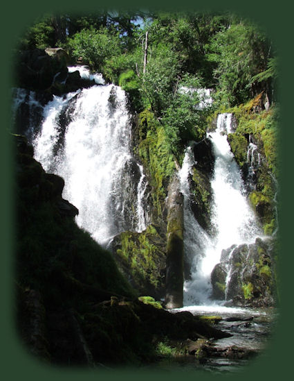
National Creek Waterfalls Heading west* on the Crater Lake Hwy, Oregon Hwy 62, you'll come to the junction for Union Creek, turn right on the Rogue Umpqua Scenic Byway, Oregon Hwy 230. Travel north 6 miles, you'll see a sign that says, "National Creek Falls 1/4 mile" on the east side of the road. You'll drive by Highway Waterfalls on the right on the Rogue River. Further north, you'll drive through mountains of volcanic ash, left behind as Mt Mazama erupted, leaving behind the beauty of Crater Lake we see today. When you see the sign for National Creek Waterfalls, turn right on FS 6530. Drive 3 miles to the junction with road 6530-300. Turn right and proceed to the parking area and trailhead at the end of the road. The hike to National Creek Waterfall is short, but through a lovely forest. The forest service rates it more difficult, and I guess it's because it goes downhill into the canyon. If a hiking trail goes down, it has to go up again. That must be why it's rated more difficult. I certainly think it's an easy hike. It's only .4 of a mile. Necessary information: the trail requires a NW Service Pass: $5.00 from the USFS, available for purchase at the trailhead. |
|
*If you're traveling north from Medford on the Crater Lake Hwy, Oregon Hwy 62, continue north beyond the junction for the turnoff to Crater Lake National Park. You'll be on the Rogue Umpqua Scenic Byway, Oregon Hwy 230. From there follow the directions as stated above. Other points of interest: Highway Waterfalls on the right. You'll drive through mountains of volcanic ash left behind when Mt Mazama erupted to leave behind the beautiful crater lake we see today. Rabbit ears, and interesting volcanic formation on the left when you drive north. And as you reach the end of Oregon Hwy 230, to connect with Oregon Hwy 138, still part of the Rogue Umpqua Scenic Byway, you'll see the jagged spires of Mt Thielsen before you. Stop at the viewpoint on the right to take a picture or two if you like. This short hike to National Creek Waterfalls is but a segment of the Crater Rim to Hamaker Campground on the Upper Rogue River Hiking trail. Protect our National Forests and Wilderness Areas. Leave NO Trace! | |
|
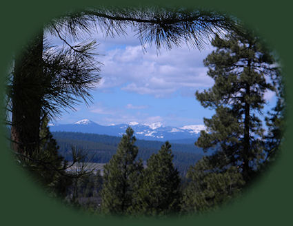
Forward ~ The forest as seen from the hiking trail to National Creek Waterfalls. Back ~ Highway Waterfalls on the Rogue River viewed when traveling the Rogue Umpqua Scenic Byway. USFS: Rogue River Siskiyou National Forest in Oregon. Poison Oak can be a problem at these elevations. Want to see a picture? Hiking trails in the Rogue Siskiyou National Forest of Oregon: the forest as seen when hiking to National Creek Waterfalls, pictured to the right. |
|
|
Explore the Diverse Loop Tour on the Rogue Umpqua Scenic Byway and Crater Lake Hwy: Directions, Map; and Scenery: waterfalls, hiking trails on the Upper Rogue River in Oregon, the Natural Bridge, the Rogue River gorge at Union Creek, Crater Lake National Park and more. Or the Umpqua Waterfall Tour on the Rogue Umpqua Scenic Byway: Travel Directions, Map and Scenery: wild and scenic rivers, waterfalls, hiking trails, hot spring, as well as Crater Lake National Park. Combine the Diverse Loop Tour & Umpqua Waterfall Tour to travel the Rogue Umpqua Scenic Byway & Crater Lake Hwy, Oregon Hwy 62: Directions & Map. Want to hike at Crater Lake National Park? Find the hiking trails at Crater Lake in Oregon. Travel Oregon and northern California while staying at Gathering Light ... a retreat | |
|
Travel on the Rogue Umpqua Scenic Byway to the retreat: Travel Directions, Map & Scenery: hiking trails, waterfalls, the wild & scenic Rogue River, the wild & scenic Umpqua River; Crater Lake National Park & more. Directions to and Day Trips in Oregon and California of around 100 miles from the retreat. Little known Scenic Places to explore: wetlands, wildlife refuges, hiking, trails, sightseeing, wildlife viewing, birding, canoeing and more near the retreat and Crater Lake National Park: Travel Directions Map and Scenery. Website Directory for the travel pages Home Page |
|
|
Contact Brad at Gathering Light ... a retreat. Hiking in Winema National Forest a little nore than a mile from Gathering Light ... a retreat, pictured above to the right. | |