Hiking Trails:
| |
| |
|
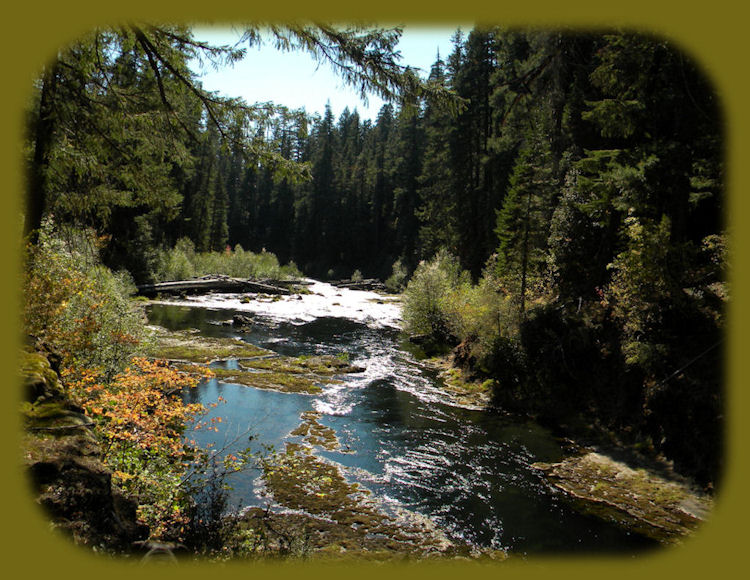
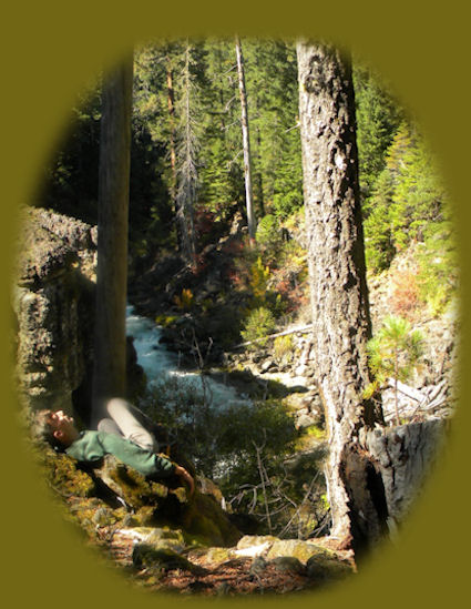
Hiking from Woodruff Bridge to the River Bridge on the Upper Rogue Hiking Trail. Autumn bathes the river: hiking on the Rogue River in OregonThe hiking trails, featured on this page, and accessed off the Rogue Umpqua Scenic Byway, Oregon Hwy 233, as well as the Crater Lake Hwy, Oregon Hwy 62, is one of two that follow the wild and scenic Rogue River. This hiking trail follows the upper Rogue River. It "ends" at Prospect, Oregon. I say that it ends there because I'm following the river, and the Rogue River begins at Boundary Springs on the western flank of Mt Mazama. Hence, that's the "first" segment of these trails along the Rogue. For those who don't know, Mt Mazama is the mountain that shapes Crater Lake. What a bonus! Visiting one natural scenic wonder gives you the other as well. :-) In this series of hiking trails, the river is divided into seven segments. Some of the hiking trails are short, by that I mean about 4 miles long one way. Others can be up to 10 miles one way. Depending on the amount of time one has, one can at least enjoy one of these hikes during a stay in this very beautiful part of Oregon. Always Remember! The river can flow very fast and hard. The picture above was taken in October. Long after the storms had subsided, so don't take this calm, peaceful meander as common. Also, the Rogue River can be quite cold. Not so cold late in the summer, but the mountain snowfalls which feed the river melt into the summer. Also, the river as it surfaces at Boundary Springs will always be cold. It's best to be prepared.:-) The Upper Rogue River Hiking Trail*1. Crater Rim Viewpoint to Hamaker Campground 2. Hamaker Campground to Foster Creek Trailhead 3. Foster Creek Trailhead to Big Bend Trailhead 4. Big Bend Trailhead to Natural Bridge Viewpoint 5. Natural Bridge Viewpoint to Woodruff Bridge Picnic Area 6. Woodruff Bridge Picnic Area to River Bridge Campground 7. River Bridge Campground to Prospect | |
Hiking from Crater Rim Viewpoint to Hamaker CampgroundI'll get the technical stuff out of the way first: The trail is seasonal, and therefore, available from June - October. It gains, or loses, in elevation, going from 5,200 to 4,000 feet. It's 9.3 miles one way, and depending if you begin at the lower or upper end, it's quite a climb. I haven't done this hike. We don't take two cars when we drive over to the Union Creek area, and we've never thought we wanted to hike almost 19 miles in one day. I would venture to say that it doesn't just go down the side of the mountain, but goes up and down, and this portion of the Rogue River National Hiking Trail is rated more difficult on the Rogue Siskiyou National Forest site. If desired, one could take along camping gear and find a place to camp somewhere up there, I suppose, but I can't say for certain because I've never been up there. Also, this trail is designated for hikers only. Pack and Saddle, off-road vehicles, mountain bikes and motorized bikes are prohibited. |
|
|
The trail is accessed from the Rogue Umpqua Scenic Byway, Oregon Hwy 230, which follows the western flank of Mt Mazama, i.e., Crater Lake National Park. If you're traveling north from the Union Creek area, you'll see the sign for Crater Rim viewpoint on the right, i.e., the eastern side of the road, this is the trailhead. If you did come from Union Creek, you'll travel about 16.5 miles from the junction of Crater Lake Hwy and the Rogue Umpqua Scenic Byway, before you see this sign. If you came from the Roseburg area, following the Umpqua River portion of the Rogue Umpqua Scenic Byway, I can't say how far you'll drive after the junction of Oregon Hwy 138 and Oregon Hwy 230. You'll just have to watch for the sign for Crater Rim on your left. Don't miss the spectacular views of Mt Thielsen seen as your driving away from it on Hwy 230. Stop and the viewpoint to get a good look if you like. Beginning at the Crater Rim Viewpoint, the trail passes through a stand of lodgepole pine. These trees are not that attractive, as you may know, but don't give up. Besides, Lodgepole Pines give evidence as to how hard it is for vegetation to grow on the frothy ash that covered the area when Mt. Mazama erupted over 6,800 years ago. After walking about .5 mile, the Boundary Springs Trail intersects with the Upper Rogue River Trail. If you want to connect with the Pacific Crest Trail instead of hiking on the Upper Rogue Hiking Trail, this this is where you do it. It's a 7.2 mile hike to the Pacific Crest Trail if you do. If not, the Upper Rogue River Trail continues to the right at this junction and heads downstream. The next two miles offers spectacular views. One vista overlooks a sharp hairpin turn sculpted into the cliff by the river. Just beyond this, Ruth Falls can be heard far below. A steep, unstable pumice cliff prevents more than a glimpse of the falls through the trees. Two miles further downstream, the trail approaches Rough Rider Falls. The trail leaves the river at this point and travels 2.5 miles through the woods, crossing Forest Service road 6530 and returning to the river's edge at Hamaker Campground on Forest Service road 900. Hiking from Hamaker Campground to Foster Creek TrailheadLike all trails on the Upper Rogue River, it's seasonal: Available from June through October. The elevation is 5,200 feet, and it's 10 miles long. Again, because of the length I haven't done this hike, but as I understand it, the trail goes up and down, and the site for the Rogue Siskiyou National Forest says this trail is more difficult. This trail,like the hiking trail from Crater Rim Viewpoint, is accessed from the Rogue Umpqua Scenic Byway, Oregon Hwy 230, approximately 14 miles from the junction of Oregon Hwy 230 and the Crater Lake Hwy, Oregon Hwy 62, where you'll find the 6530 road. If you're heading south, turn right; if you're heading north from Oregon Hwy 138, turn left, and follow this road until you reach the 900 road. Trail begins east of Hamaker Campground. | |
|
For ten miles follow this meandering trail along the Upper Rogue River as it winds through marshy meadows and carves channels in buff-colored pumice. It begins on Forest Service road 900, across from Hamaker Campground. The trail heads away from the river through a stand of white fir and western white pine. It joins the river 2.0 miles later near the confluence of Muir Creek and the Upper Rogue River. From there it continues south through grassy meadows with alder thickets and huckleberry bushes bordering the marshy river channel. After crossing Hurryon Creek, the grade fluctuates as the trail crosses a series of pumice banks before reaching the riverbank again near Highway Falls. The river pours over a short section of rapids, then turns sharply south to parallel Highway 230. (See picture of Highway Falls.) Beyond Highway Falls, the trail climbs to the top of a pumice cliff and offers a dramatic view of the river, finding its way through a maze of logjams far below. The trail descends with a series of switchbacks to the riverbank, following it closely through a secluded stand of mature forest. After crossing National Creek on a foot log, the trail climbs to Forest Service road 6530, crosses the river on the road bridge embankment to continue south along the west bank. The last 0.5 mile of trail climbs over the highway and drops through a series of switchbacks to the Foster Creek Trailhead. |
|
Foster Creek Trailhead to Big Bend TrailheadLike the others, this segment of the Upper Rogue River Hiking trail is seasonal, safely available from June through October. It's 7 miles long, and rated easiest. Available to both hikers and pack and saddle. Prohibited: motorized bikes, mountain bikes, ATVs and four-wheel drive vehicles. It's barrier free. Foster Creek Trailhead is accessed right off of Hwy 230. Easy to find. It's south of the Hamaker Campground trailhead. For 7 miles of easy walking, the trail explores a peaceful section of the Upper Rogue River Canyon, then continues south to join Hershberger road 6510. The scene is unique because it reveals the Rogue's continuing struggle to recover from the pumice avalanche that buried its channel during the eruptions of Mt. Mazama. Eroded pumice bluffs and exposed lava rock from earlier lava flows testify to the river's erosive abilities. Here, the Rogue follows a meandering path through a maze of abandoned oxbows, peninsulas, and forested islands. Leaving from the Foster Creek trailhead on Highway 230, the trail fords Foster Creek and finds its way through a brushy riparian thicket into a mature conifer forest. A varied array of small plants carpets the forest floor. The most common species are vanilla leaf, squaw carpet, Oregon grape, inside-out flower, pinemat manzanita and wild strawberry. About 1.0 mile downstream, the trail leaves the river for a short time to climb a pumice cliff. The trail also passes through one of many marshy areas inhabited by skunk cabbage and a variety of small water creatures. Besides the abundant wildlife of the area, cattle are frequently seen grazing in the meadows along the riverbank. Several large logjams slow the flow of the river and offer shelter for cutthroat trout. Five miles downstream, on the south side of the footbridge, the trail passes the abandoned 0.5 mile trail west to the old Brown's Cabin trailhead. Brown's Cabin was the site of an early day Forest Service ranger station. Continuing south, the trail climbs and traverses a pumice bluff with views of the rapids below. The trail follows the river's edge as it winds around Big Bend and terminates on Forest Service road 6510, one mile from the junction with Highway 230. Big Bend Trailhead to Natural Bridge ViewpointNow this is a trail I have followed. For about half the way before we turned around and made our way back to the viewpoint for the Natural Bridge. We tried this trail in November, after the recommended dates for these seasonal trails, and it was wet. We got wet, walking through the tall grass in one place. The trail goes up and down, but like the other segments of the Upper Rogue River Trail I've hiked, it's beautiful. Worth the wet grass, no doubt. Though I wouldn't recommend anyone try hiking it beyond October. We decided not to do this again, and we haven't. If we knew the river better, it might be okay, and I'm sure people who live in the area will try it during other times of the year, but rivers, like mountains, can be treacherous, no matter how beautiful they may be. The trail is 7 miles long, ascending and descending around an elevation of 3,300 feet. The US forest service rates it more difficult. For hikers only, all other groups: ATVs, 4-wheel drives, mountain bikes, motorized bikes, are prohibited. It's barrier free. | |
|
The description I'm giving here begins at the Big Bend trailhead on Forest Service road 6510, 1 mile west of Highway 230. (As stated above, we began from the Natural Bridge, which is something anyone can do, depending on his/her preference.) The trail as described here, starts at FS road 6510, climbs a rocky embankment, and traverses a steep slope overlooking the Upper Rogue River. A brief opening in the trees offers a glimpse of Fish Mountain to the north. The trail rises and falls with frequent switchbacks following gullies in the terrain. Two miles south, a steep forested slope overlooks Farewell Bend Campground across the Upper Rogue River. At the southern end of the campground area, the trail momentarily descends to river level to view the river raging through the long, narrow chute of a collapsed lava tube. Continuing south, the trail will wander away from the river. One mile south of the Flat Creek crossing, the trail junctions with a tie-thru trail which leads to a footbridge crossing the Upper Rogue River. This bridge provides access to the Rogue Gorge Trail and the north end of the Natural Bridge Campground. Continuing south on the Upper Rogue River Trail for the final mile of this segment leads to the Natural Bridge Viewpoint and footbridge. This area is 0.5 mile west of Highway 62, accessible by Forest Service road 300. |
|
|
In this instance, as in all others, be prepared. You should be aware that Flat Creek has no bridge and must be waded. Water levels can be high in spring and after heavy rains. Natural Bridge Viewpoint to Woodruff Bridge Picnic AreaThis also is a hiking trail I've walked, and it's quite easy. Beautiful and easy. :-) It's only 3.5 miles long one way, making it a mere 7.0 miles to walk back to the car. Like the others, it's open from June through October. For hikers only, with all other categories prohibited: pack and saddle, ATVs, motorized bikes, mountain bikes, 4-wheel drive vehicles. It's barrier free. If you're driving south from Union Creek on the Crater Lake Hwy, or driving north from Medford, Oregon, look for the Natural Bridge sign from the road. It's easy to find. The Natural Bridge, a feature with geologic, historic and scenic interest, marks the beginning of this 3.5 mile section of the trail. The hiking trail follows the Upper Rogue River bank along a picturesque and diverse section of the river. As stated in another place, the river is swallowed by an underground maze of lava tubes at the Natural Bridge. When it resurfaces, a small portion of the flow is released into a small pool directly below the bridge. The remainder of the diverted water surges back to the surface and is visible from the viewpoint bridge. The largest of these angles out from under the east bank into the main channel, returning the river to its full strength. The trail begins 0.5 mile west of Highway 62, near the Natural Bridge Viewpoint bridge. The route winds along the bank over a rough tread of mossy lava rock which becomes very slippery in wet weather. Vegetation along the trail alternates between sheltering old-growth forest and brush, while the river's character varies between rapids and pools of quiet water. The trail climbs high above the river where it bends sharply and rages through the narrow chute of a collapsed lava tube. This beautiful rapids is known as Knob Falls. As the trail approaches Woodruff Bridge, several old skid roads are encountered. Plan a picnic for the picnic area at Woodruff Bridge if desired. The Rogue River at Woodruff Bridge is quite beautiful, whether or not your elect to take the hike. Furthermore, this is also a favorite fishing spot. Please use caution around the water - the river is dangerous due to extremely cold water and a strong, forceful current. | |
|
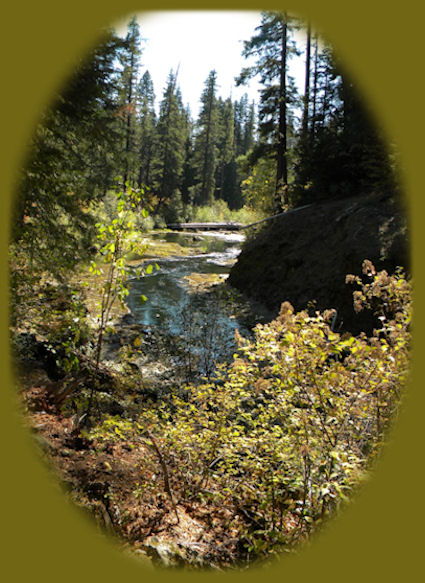
Woodruff Bridge Picnic Area to River Bridge CampgroundOnce again for the technicalities: The trail is open from June through October. It's at an elevation of 2700', and it's 4.6 miles long. Like most of the hikes on the Upper Rogue Hiking Trail it is developed for hikers ONLY. All other uses are prohibited. This too is a hike I've taken, and oh, the lovelies on this route. The picture of the Rogue displayed above, was taken on this hiking trail in October. Easy to find, look for the sign for woodruff Bridge from the Crater Lake Hwy. If you're heading south from Union Creek, it will be on the right. If you're heading north from Medford, Oregon, it will be on the left. The road you take to get to Woodruff Bridge is not very good. Indeed, a description of "not very good" is an understatement. Unless the situation has improved since last summer, be sure to keep a lookout for potholes - BIG potholes. They won't stop your trip, just keep a lookout. |
|
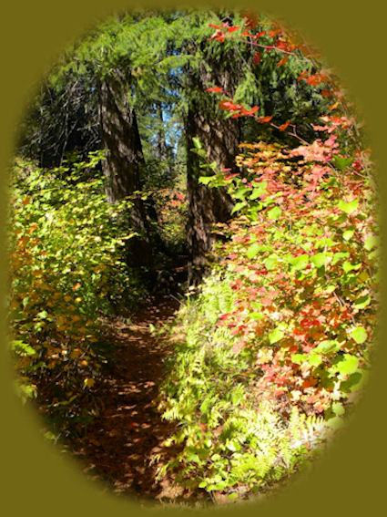
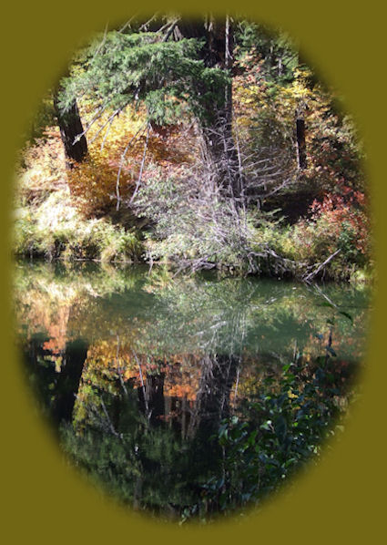
Now for the lovelies: The wild raging character of the Upper Rogue River passing through Takelma Gorge is a key attraction. We just took this trail on a whim, had no idea what we'd find, and oh my! The wonder of the vista as it opened up before us. Beginning from the Woodruff Bridge Picnic Area on Forest Service road 68, the trail heads downstream past a scarred, eroded pumice slope on the opposite bank. Alder, vine maple, cow parsnip, and horsetail line the river until it reaches the dark-colored lava cliffs of Takelma Gorge, 1.5 miles south. Here the river drops through a series of rapids and turns sharply to enter the gorge itself. The narrow channel continues for 0.5 miles. This section of trail has a rocky tread with a few steeper grades. Below Takelma Gorge, the river widens and flows calmly past the Union Rogue Baptist Church Camp, while the trail returns to pumice flats along the river. Raptors, such as the shy goshawk, can be seen on this section of the river. The trail ends at the River Bridge Campground on Forest Service road 6210. River Bridge Campground to ProspectThis is the section of the Upper Rogue Hiking Trail that offers the least appeal I think, but only because of the end of it when this fork of the Rogue and the south fork are forced into wooden pipes. Before that, the hike is every bit as beautiful as all the others. We've hiked a portion of it beginning at the River Bridge trailhead. Again, it's available from June through October. We tried it in October, which was when we made the other hikes as well. It's 6.5 miles long, and available only to hikers not being designed for: Pack and Saddle, Mountain Bike, Motorized Bike, ATV and 4-Wheel Drive. It's Barrier Free It's easy to find the trail. When driving on the Crater Lake Hwy, look for the signs for River Bridge Campground. If you're heading south from Union Creek it will be on the right; if you're heading north from Medford, Oregon, it will be on the left. Follow the road (FS 6210) for one mile until you come to the campground. Park, find the trail on the south side of the road. Obviously, if you went to the north side of the road and got onto the hiking trail, you'd be on the Woodruff Bridge - River Bridge segment of the Upper Rogue River Hiking Trail. If you elect to go south, the trail crosses a brushy, sandy beach piled with driftwood and enters a stand of tall sugar pine, which has carpeted the forest floor with its needles and cones. Occasional views of the river occur where the trail nears the edge of 20-foot bluffs bordering the river channel. The last 4 miles of trail leave the river and wind through a stand of younger trees. The backwaters of the reservoir are visible as the trail returns to the riverbank. It then joins and follows an old road to the picnic area at the edge of the reservoir. A 0.5 mile access road connects to Hwy. 62 from the dam, marking the end of the Upper Rogue River Trail. *The information for these trails comes from the former website for the Rogue Siskiyou National Forest. Poison Oak can be a problem at these elevations. Want to see a picture? Indeed, I took this photo not far from here, at the viewpoint for Mill and Barr Creek waterfalls in Prospect, Oregon. Protect our National Forests and Wilderness Areas. Leave NO Trace! | |
|
|
The wild and scenic Rogue River Forward ~ The Rogue River at Union Creek: Directions. Back ~ Sightseeing in the Cascade Mountains of southwest Oregon. USFS: Rogue River Siskiyou National Forest in Oregon. Explore the Diverse Loop Tour on the Rogue Umpqua Scenic Byway and Crater Lake Hwy, Oregon Hwy 62: Directions, Map; and Scenery: waterfalls, hiking trails, the Rogue River Gorge at Union Creek, Oregon, the Natural Bridge, the Cascade Mountains, Diamond Lake, Crater Lake and more. Or the Umpqua Waterfall Tour on the Rogue Umpqua Scenic Byway: Travel Directions, Map and Scenery: wild and scenic rivers, waterfalls, hiking trails, Crater Lake; hot springs. |
|
Combine the Diverse Loop Tour & Umpqua Waterfall Tour to travel the Rogue Umpqua Scenic Byway & Crater Lake Hwy: Directions & Map. Want to hike? Hiking Trails at Crater Lake National Park in Oregon. Travel Oregon and northern California while staying at Gathering Light ... a retreat | |
|
Travel the Rogue Umpqua Scenic Byway to the retreat: Travel Directions, Map & Scenery: hiking trails, waterfalls, the wild & scenic Rogue River, the wild & scenic Umpqua River; Crater Lake National Park & more. Directions to & Day Trips in Oregon & California of around 100 miles from the retreat. Explore little known Scenic Places: wetlands, wildlife refuges, hiking and birding trails, sightseeing, wildlife viewing, canoeing & more near the retreat & Crater Lake National Park: Travel Directions Map & Scenery. Website Directory for the travel pages Home Page |
|
|
Contact Brad at Gathering Light ... a retreat. Walking along the river at Gathering Light ... a retreat, pictured above. | |