|
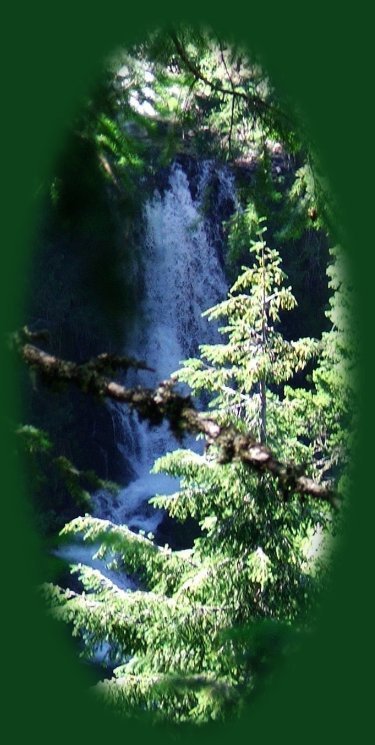
Travel Oregon and ...Upper Diamond Creek Waterfall If you stop to take in Salt Creek Falls and have a little time, hike, cross country ski or snow shoe on the Salt Creek Falls Hiking Trail. The trail offers some amazing views of Salt Creek and Diamond Creek Canyons. Map: Cross Salt Creek to the trailhead: The trail is clearly marked, head upstream along the creek and cross the bridge. Turn right and this waterfall will be the second or third sight of significance on the hike. Second if you don't count the view you get of Salt Creek Waterfalls from above. The first is Too Much Bear Lake. There are two or three viewpoints of this waterfall from the trail. I have not done this because I always thought the trail that went off to the left here was the trail to Vivian Lake, but it is possible to hike down into the canyon and view the waterfall from that perspective. The trail is steep, following a series of steps created out of hewn logs, but this waterfall is beautiful. This photograph does not do it justice, not by any means. Protect our National Forests and Wilderness Areas. | ||
|
Hiking trails on the Willamette Pass, Oregon Hwy 58, in the Willamette National | |||
|
Forward ~ Lower Diamond Creek. Back ~ Too Much Bear Lake, a lovely little turnoff USFS: Willamette National Forest. USFS: Deschutes Ochoco National Forest. |
| ||
|
Explore the Willamette Pass, Oregon Hwy 58, in the Willamette National Forest of the Cascade Mountains in Oregon: Hiking trails, the Waldo Lake Wilderness and the Diamond Peak Wilderness, Salt Creek Waterfalls, hiking trails to Diamond Creek Waterfalls, mountain lakes, waterfalls, fishing, boating, swimming, camping, snow skiing cross country skiing, and snow boarding at the summit, snowmobile riding and more: Directions, Map and Scenery. Want to hike or cross country ski? Try the trails at Salt Creek. Perhaps try an alternative scenic route to travel Oregon. Travel along the Middle Fork of the Willamette River. Call about road conditions first. If you're heading west on the Willamette Pass, the route given on the site goes east, you might want to connect with the West Cascades National Scenic Byway. Travel Directions, Map: page 1 and page 2, and Scenery: offering mountains, hardened lava flows, wild and scenic rivers, waterfalls, hiking trails, hot springs, old growth forests, mountain lakes, forest service campgrounds. The West Cascades National Scenic Byway provides easy access to the Three Sisters Wilderness, the Mt Jefferson Wilderness and the Mt Washington Wilderness, all located in the Willamette National Forest. Travel Oregon and northern California while staying at Gathering Light ... a retreat | |||
|
|
Travel to the retreat on the Willamette Pass, Hwy 58: Travel Directions, Map and Scenery. Find hiking trails, the Waldo Lake Wilderness and the Diamond Peak Wilderness in the Willamette National Forest, Salt Creek Waterfalls, hiking trails to Diamond Creek Waterfalls, expansive vistas of Diamond Peak and Mt Yuron, Odell Lake. Travel Directions to & Day Trips of around 100 miles from the retreat. Little known Scenic Places: hiking, sightseeing, wildlife viewing, birding & more near Crater Lake & the retreat: Travel Directions Map and Scenery. Website Directory for the travel pages Home Page | ||
|
Contact Brad at Gathering Light ... a retreat. | |||