|
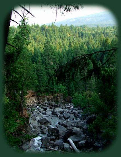
The Avenue of Giant Boulders at Prospect OregonThe Avenue of Giant Boulders can be viewed from above, standing on the bridge and from atop the canyon walls on the north side of the bridge. If you elect to take this option, be aware there are no railings, no fences. There are obvious paths made by the many people who have walked along the top of the canyon, and the views can be quite lovely, but it is possible to fall off. I was told a story once of a man who drove his pickup off the canyon wall late at night. I don't know if he survived. I don't even know how he could do this. Still, the story came from a good source, so I believe it. I tell you this only so you'll exercise caution. |
|
It is possible to walk down to the Avenue of Giant Boulders from the bridge. It's not a hike in the sense of being marked out or anything like that. There's not a trail. Still, it's possible to walk down from the south side of the bridge. One should take care and always remember that if the dam upstream is opened the water comes through in a thunderous hurry. Warnings are posted further down, but if you take this route, I don't think you'll see any warning signs. So, if you decide to do this PAY ATTENTION TO THE WATER :-). I've seldom seen it come through, nevertheless, I have seen it, so I know what it's like. Take precautions. The Avenue of Giant Boulders can also be accessed from the trailhead a little further south on the road from Prospect. This property is privately owned by a logging company. It used to be Boise Cascade, but it's something else now - I can't remember. Anyway, drive south from the bridge, and before long you'll see a small parking lot to the left. Pull in; park. You'll see a map of the hiking trails carved in wood. There are two paths laid out, and the enthusiastic hiker can take both directions. They're short and easy. However, to get down to the Avenue of Giant Boulders from here, walk down the trail until it forks left or right. Take the fork to the left will take you to the Avenue of Giant Boulders. The walk is not long & well worth the effort. | |
|
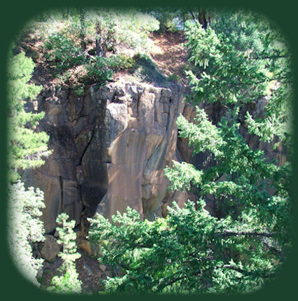
The Canyon Walls at the Avenue of Giant Boulders Forward ~ The Avenue of Giant Boulders. Back ~ Barr Creek Waterfall. USFS: Rogue River Siskiyou National Forest in Oregon. Explore the Diverse Loop Tour on the Rogue Umpqua Scenic Byway and the Crater Lake Hwy, Oregon Hwy 62: Travel Directions, Map; & Scenery: waterfalls, hiking trails, the Rogue River Gorge at Union Creek, Oregon, the Natural Bridge, the Cascade Mountains, Diamond Lake, Crater Lake and more. Crater Lake also on the the Umpqua Waterfall Tour: Travel Directions, Map & Scenery: Crater Lake, wild & scenic rivers, waterfalls, hiking; hot springs. Want to hike? Hiking Trails at Crater Lake. |
|
Poison Oak can be a problem at these elevations. Want to see a picture. Indeed, I took this picture right there, at the viewpoint for Mill Creek and Barr Creek Waterfalls! Travel Oregon and northern California while staying at Gathering Light ... a retreat | |
|
Travel on the Rogue Umpqua Scenic Byway to the retreat: Directions, Map & Scenery: hiking trails, waterfalls, the wild and scenic Umpqua River; Crater Lake and more. Travel Directions to and Day Trips in Oregon and California of around 100 miles from the retreat. Explore little known scenic places: hiking, sightseeing, wildlife viewing, birding; more near the retreat & Crater Lake National Park: Directions Map & Scenery. Website Directory for the travel pages Home Page |
|
|
Contact Brad at Gathering Light ... a retreat. | |