|
The Cow Creek Tour Route in Oregon: | |

| |
|
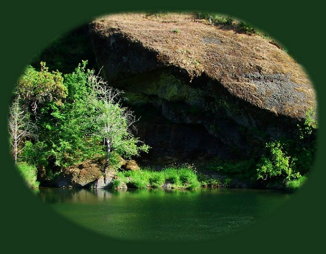
Brad and I decided to get off the beaten path and check out Cow Creek. I'd long been curious about it. We didn't actually know what to look for. We took the route described below after looking at a map of Oregon. At one place we pulled off the road to what appears to be a popular swimming hole. (Pictured Above.) We spent the evening enjoying ourselves along the water, and then moved on. If you want an escape from monotonous freeway driving, as Brad and I often do, the Cow Creek Tour Route offers a picturesque, pleasant break. A detour of 45 miles wanders along Cow Creek, dipping through mountains, farms and ranches, forests, interesting rock outcroppings, and seasonal waterfalls. Depending on the time of year, you can enjoy vibrant wildflowers or deciduous trees and foliage ablaze with autumn. No matter the time of year, Cow Creek flows brilliant emerald. The photograph above was taken during June. It was a great day for a dip. Distance: 45 miles. Starting Point: I-5, at Exit 103, 21 miles south of Roseburg. Minimum Driving Time: 1-2 Hours. Best Time to Drive: Spring for abundant waterfalls and wildflowers; fall for stunning colors. This route gives a welcome break from the monotonous freeway driving of I-5. Trade 23 miles of freeway between mileposts 103 and 80 for 45 miles of nature's splendor along the meander of lower Cow Creek. Leave I - 5 at exit 103, 21 miles south of Roseburg, Oregon. Follow Cow Creek Road past Riddle, a railroad town named after an 1851 pioneer. If you need gas, or food, stop here. Riddle offers the last opportunity for either until the end of the route. If you're interested, mine sites and tailings of the last operating nickel mine and smelter in the continental United States can be found here. Drive by farms and ranches as you travel west, before they give way to the forests of Cow Creek Canyon. Shortly after passing Tunnel No.1 of the historic Oregon and California Railroad, you'll find a rest stop. Stop if you have the need, or perhaps you'd just like to try your hand at panning for gold as miners did here nearly 150 years ago. Apart from that, the many spring waterfalls and wildflowers, mixed with old-growth Douglas-fir and magnificent rock outcroppings, fill the journey with vistas beautiful enough to make the journey worthwhile. In the fall, deciduous trees turn bright red and yellow, as salmon return to spawn in the cold, crisp waters of the creek. Passing the West Fork of Cow Creek, you'll see two steel girder bridges built in 1905 and still in use today. As the road rises beyond Skull Creek Campground, the landscape changes, traveling through farms once again. Return to I-5 at Exit 80, 18 miles north of Grants Pass, Oregon. For more information, call the BLM Roseburg Office at 541-440-4930. | |
|
Forward ~ The road less traveled: Leisurely routes that meander along streambeds and river canyons. Back ~ Travel to the South Umpqua River waterfalls in the Umpqua National Forest. USFS: Umpqua National Forest in Oregon. Poison Oak can be a problem at these elevations. Want to see a picture? Plan your visit to the many waterfalls and hiking trails in the Umpqua National Forest. Want to learn more about the campgrounds on the North Umpqua River and others in the Umpqua River watershed? |
|
|
Travel Oregon and northern California while staying at Gathering Light ... a retreat | |

|
Travel the Rogue Umpqua Scenic Byway to the retreat: Directions Map & Scenery. Experience the grandeur of Toketee, Lemolo & Watson Falls, the wild & scenic Umpqua River & Crater Lake National Park. Travel Directions to & Day Trips in either Oregon or California of about 100 miles from the retreat. Little known Scenic Places: hiking trails, wetlands, national wildlife refuges, mountains, wilderness areas, river gorges & more near Crater Lake National Park & the retreat: Travel Directions, Map & Scenery. Website Directory for the travel pages Home Page Contact Brad at Gathering Light ... a retreat. |
|
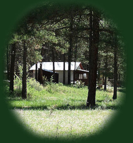
Cabin 5 photographed from the floodplain at Gathering Light ... a retreat. Rustic simplicity, a place to "Just Be", Gathering Light is nestled on the banks of the river, surrounded by the Fremont Winema National Forest of southern Oregon and not far from Crater Lake National Park. | |