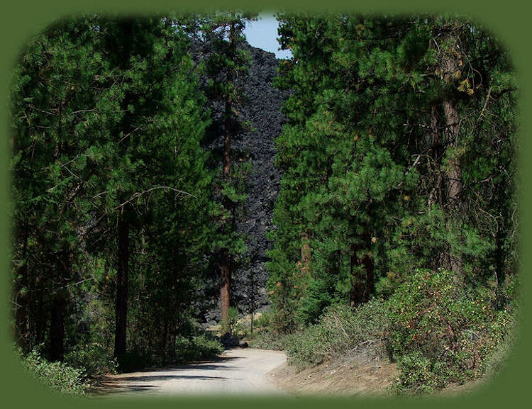
Driving into the Lava Flow Campground at Davis Lake
in Central Oregon near more than 100 other alpine lakes
on the Cascade Lakes National Scenic Byway
Davis Lake, complemented by mountainous lava flows, is located at the southern end of Cascade Lakes National Scenic Byway. A picturesque setting in the Deschutes National Forest, the lake was formed approximately 6,000 years ago by a lava flow cutting off Odell Creek. Today it is a large and shallow lake, named after Button Davis, a nineteenth century stockman from the Prineville area who ran cattle in the vicinity of the lake (ODFW, 1996).
It is assumed that Odell Creek probably directly connected to the upper Deschutes River prior to the volcanic eruption. The 3,000 surface acres of shallow water coupled with the primary inlet Odell Creek, makes Davis Lake a very rich and productive aquatic system.
Fishing at Davis Lake in the Deschutes National Forest
Davis Lake is one of the most productive wildlife areas in central Oregon although this can vary, as water levels depend upon the weather. Even so, it is a very popular fishing spot, and add to that spectacular views of the Cascade Mountains, you have a very nice place
for fishing or otherwise. Motorized and non-motorized boats are allowed on this lake,
but it is open to fly fishing only. Nevertheless, it is one of the most popular fly fishing only lakes in the Pacific Northwest. Rainbow trout in the 2-5 lb range are common during wet years. Largemouth bass were illegally introduced in 1995 and seem to be thriving.
The lake is open for fishing from May to October, although road access to the lake's northeast shore and Lava Campground is closed in spring and early summer to protect vulnerable wildlife. The entire area is inaccessible in winter due to snow. To know how the fishing is, get a weekly fishing report from Oregon Department of Fish and Wildlife. A boat or float tube is needed to have access to the best fishing sites.
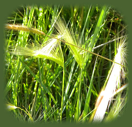
The lakeshore is characterized by reeds, grasses and muddy bottom, which make it quite difficult to wade and fish from the shore. The most productive areas for fishing are found at the northeast end of Davis Lake near the lava dam; the west shore between Ranger and Moore Creeks and in the Odell Creek Channel.
Wildlife Viewing
On a spring day one can identify 40 - 50 animal species. As
a possibility, three terns: Caspian, Forster's, and black. Four grebes: pied-billed, horned, eared, and western. And even non-nesting American white pelican. Woodpeckers
take advantage of insect activity in dead and stressed trees as a result of the Davis fire a few years ago, and seem to be doing well. In particular, black-backed woodpeckers can be seen within the fire area nearby. Great gray owl on the west side, in addition, bald eagle and osprey nest at the lake. The riparian shrubbery bordering Crescent Creek conceals ruffed grouse. Rare-to-Oregon birds that sometimes visit here include scissor-tailed flycatcher, northern parula, and semipalmated sandpiper. Look for American pika on lava of the northeast shore and Rocky Mountain elk along the west shore. From a boat,
it's possible to catch a glimpse of rainbow trout or largemouth bass near bulrush reeds at the north shore. Other attractions include habitat for northern spotted owl at Davis Mountain and Hamner Butte - not that far away.
Boat Launch
An unimproved boat ramp can be found at Lava Flow Campground (North Campground).
Directions to Davis Lake in the Deschutes National Forest of Oregon
Directions from Crescent: Travel 8.8 miles west on County Road 61, then 7.7 miles north on the Cascade Lakes National Scenic Byway, FR 46. You'll see the signs for Davis Lake, and from here you can decide which of the campgrounds you want to visit.
Directions from La Pine, Oregon: Travel south on Hwy 97 for 11.8 miles to Forest Road 62, turn west onto Forest Road 62 for 13.5 miles to F.R. 46, at stop sign continue west on Forest Road 62 for 0.3 mile to Jct. of Forest Road 62-850 and Forest Road 62-855, both graveled. Turn north onto Forest Road 62-850 and follow signs for 0.7 mile to Davis Lake at Lava Flow Campground OR turn south onto Forest Road 62-855 and follow signs for 1.8 miles to Davis Lake at East Davis Campground. (East Davis Lake campground was damaged by
the Davis fire. If you want to know more, check the Davis Lake Campgrounds.)
The total distance is 26 miles, and the estimated time barring any unforeseen road conditions, etc. is 35 minutes.
Information about Davis Lake Campgrounds in the Deschutes National Forest.
Protect our National Forests and Wilderness Areas. Leave NO Trace!
To make sure we do it all, Check the 7 Principles of "Leave NO Trace!".
|
|
Travel on the West Cascades National Scenic Byway to Gathering Light ... a retreat: Travel Directions, Map and Scenery: wild and scenic rivers, hiking trails, mountains and volcanoes, old growth forests and more.
Directions to and Day Trips in either Oregon or California of about 100 miles from the retreat.
Explore little Known Scenic Places near Crater Lake and the retreat: Travel Directions, Map and Scenery: hiking trails, river gorges, wetlands and wildlife refuges, birding trails, canoeing and more.
Website Directory
Page Listing
Home Page
|