|
Traveling the High Desert of Eastern Oregon: | ||||||

|
Forward ~ Sightseeing in the Warner Mountains in Eastern Oregon. Back ~ Abert Rim on the Oregon Outback Scenic Byway USFS: Deschutes Ochoco National Forest. Brad & I are happy to present the Central Oregon and the Oregon Outback Tour: Directions, Map and Scenery for your enjoyment. | |||||
|
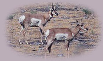
Although easily seen at Hart Mountain National Antelope Refuge, antelope may be encountered in other places. as well, in eastern Oregon. These antelope were photographed in the vicinity of Silver Lake off Hwy 31. Hwy 31 originates south of LaPine, Oregon on Hwy 97 cutting a swathe through Klamath Marsh and then the Klamath Forest Wildlife Refuge, heading east towards Silver Lake. Continuing east to Summer Lake, find hot springs and Big Horn Sheep on the ridge across from Summer Lake (not pictured), which is also not far from where the antelope were photographed. | ||||||

| ||||||
|
Soft mauves cast in the day's lengthening shadows mutes the austerity of the high desert in Central and Eastern Oregon. Travel Oregon and northern California while staying at Gathering Light ... a retreat | ||||||
|
|
Travel to the retreat on the West Cascades National Scenic Byway: Directions, Map & Scenery: hiking trails, waterfalls, wild and scenic rivers; volcanoes, lava flows ... Travel Directions to and Day Trips of around 100 miles from the retreat. Little known Scenic Places: hiking trails, wildlife viewing, birding, and more near the retreat and Crater Lake: Directions Map and Scenery Website Directory for the travel pages Home Page | |||||
|
Contact Brad at Gathering Light ... a retreat. | ||||||