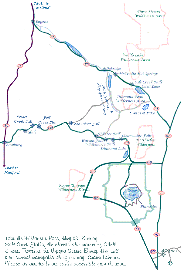
Map of the Willamette Pass, Hwy 58, & the
| |
|
Our Getaways offer written Directions, Maps and suggested scenery, spanning Oregon and northern California; Protect our National Forests and Wilderness Areas. Leave NO Trace! | |
|
|
Forward ~ Scenery on the Willamette Pass. Back ~ West Cascades National Scenic Byway: Scenery. Scenery on the Willamette Pass & on the Rogue Umpqua Scenic Byway. The Crescent Oakridge "Inback" Tour. Travel the Aufderheide, a National Forest Scenic Byway. You may want to bookmark this page before moving onto these links. Travel to the retreat on Hwy 58 or 138 page 1, page 2. Travel Directions to and Day Trips of around 100 miles from the retreat. Little known "Scenic Places" near the retreat: & Crater Lake: Directions, Map & Scenery. Local Maps Introduction. |
|
Contact Brad at Gathering Light ... a retreat. | |